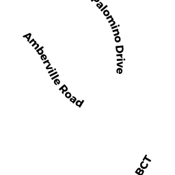
186 AMBERVILLE ROAD
Owner Information
MALVEY JR., EDWARD, M.
186 AMBERVILLE ROAD
NORTH ANDOVER, MA 01845


Property Details
186 AMBERVILLE ROAD is classified as a Single Family Residential (Colonial).
The primary structure on this property was built in 2004. There are 2,438ft2 of built area within this property. There is 2,438ft2 of residential/living space within this property. This property is listed as having 8 rooms.
186 AMBERVILLE ROAD is valued at $585,900. The land is valued at $222,400 and the structures are valued at $363,500.
This property is in Zone VR. Confirm with local Zoning Board authorities to ensure there are no overlays or other easements on this property.
The most recent deed for 186 AMBERVILLE ROAD is recorded at the local registrar in Book 12485, Page 317. 186 AMBERVILLE ROAD was last sold on Thursday, May 12, 2011 for $574,000.
Assessment data from fiscal year 2022.
Flood Data
According to the FEMA National Flood Hazard Layer, this property does not appear to be in a flood zone. It may also be in an area not yet reviewed. Nonetheless, confirm this information prior to taking any action.
To view the flood hazards around this property, create a FEMA "Firmette" Map of the area around 186 AMBERVILLE ROAD.
Broadband Internet Providers
| Provider | Type | Bandwidth (mbps) | |
|---|---|---|---|
| VSAT Systems, LLC. | Satellite | 2 | 1 |
| GCI Communication Corp. | Satellite | 0 | 0 |
| HughesNet | Satellite | 25 | 3 |
| T-Mobile | Fixed Wireless | 25 | 3 |
| Verizon New England Inc. | Fiber | 940 | 880 |
| Comcast | Cable | 1000 | 35 |
| Verizon New England Inc. | DSL | 5 | 0 |
| Viasat Inc | Satellite | 100 | 3 |
Broadband service provider data from December 2020.
Adjacent Properties
- 125 PALOMINO DRIVE
Single Family Residential owned by CHAWLA, SUDEEP - 115 PALOMINO DRIVE
Single Family Residential owned by PADMAWAR & KONTAMWAR REVC TRST - 135 PALOMINO DRIVE
Single Family Residential owned by MAGID, ALFRED, S. - 194 AMBERVILLE ROAD
Single Family Residential owned by KRISHNAN, RAMACHANDRAN - 180 AMBERVILLE ROAD
Single Family Residential owned by ONAMADE, IROSO